
Engineering & Geological surveys
The company carries out activity in the field of the geological provisions, aligned with study and development of mineral resources on the shelf of the sea and internal reservoirs
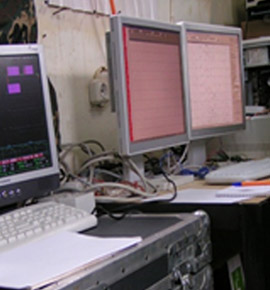
Interpretation complex
A complex of hydrographic and geophysical surveys, including the engineering-geological researches (EGR) of the sea, land and a transit zone. All main types of geologic-geophysical researches. Land, cartographical works
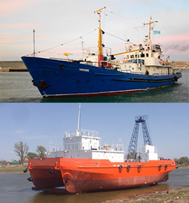
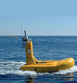
Company ship-owner
«Caspian Engineering Company» is the operator of several specialized research vessels, allowing us to be positioned surely in the market of sea research services
NAVIGATION SATELLITE SYSTEMS (GNSS)
The global satellite systems of positioning, operating in the differential C-Nav mode are intended for determination of coordinates with high accuracy, practically in every point of the Earth.
C-Nav 30500
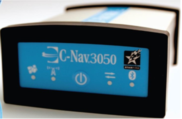 | Number of channels | 66 |
| Accuracy planned | 10 sm | |
| Accuracy of altitude | 15 sm | |
| Support | GPS, GLONASS, GALILEO, SBAS, external RTCM | |
| Frequencies | L1, L2, L5, G1&G2 |
RTK systems
GNSS receivers of the most authoritative world company Trimble are used in the Caspian Engineering Company. RTK of Trimble system provides centimeter accuracy in real time and can be used in the most various offshore and onshore works
| Support | GPS, GLONASS, GALILEO, QZSS, SBAS, Compass, OmniSTAR | 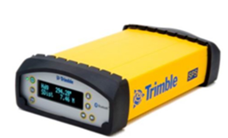 |
| Frequencies | L1, L2, L1C, L1 SAIF, L1CBOC, E5A, E5B, L2C, L5, B1, B2, B3 |
| Support | GPS, GLONASS, GALILEO, SBAS, OmniSTAR | 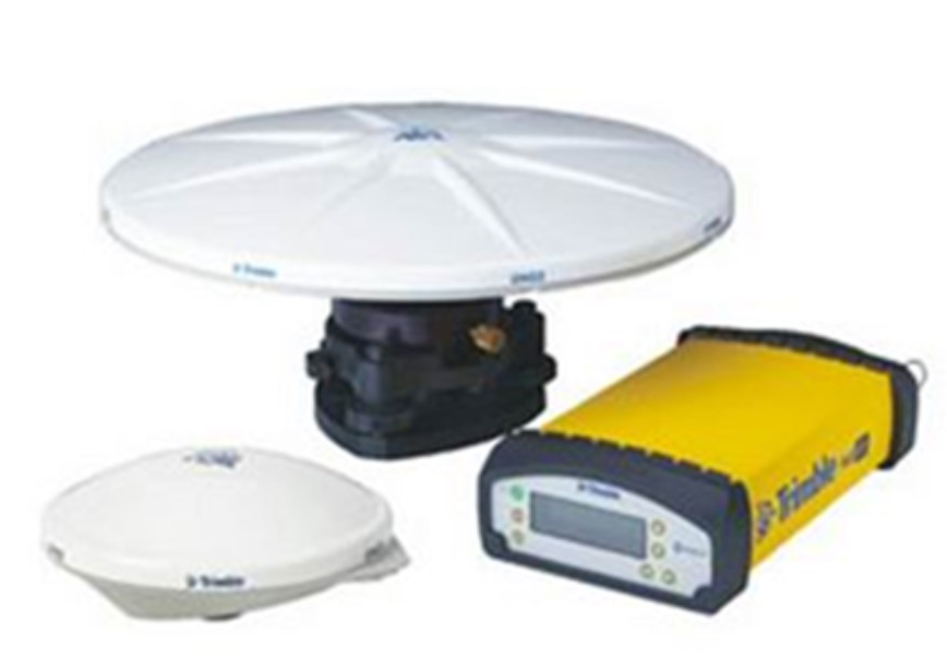 |
| | |
Multibeam echo sounders
Multibeam echo sounders are used to perform surveying work on large areas in high detail and continuous coating the bottom of the shooting.
 | Multibeam sonar WASSP-S with an antenna with a cable length of 10 m Manufacturing: WASSP-ENL (New Zealand) Main characteristics: the operating frequency of 160 kHz Radiated Power: 1.2 kW viewing angle of 120 degrees the maximum depth of 200 m bandwidth coverage depths 3.4 number of beams 224 beamwidth 4 degrees Resolution 75 mm |
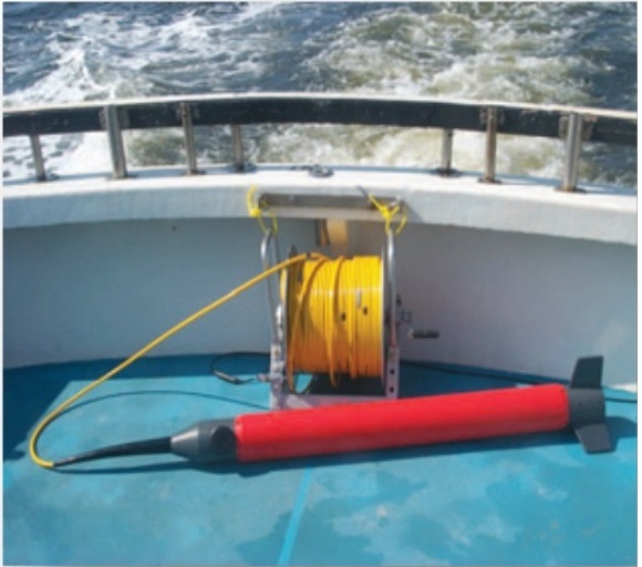
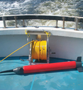
Side-scan sonar C-Max CM2 (ГЛБО)
System side-scan sonar C-MAX is one of the most reliable. Model CM2 different extended functionality, user-friendly design, simple operation, and he has earned the respect of users worldwide.
C-MAX СМ2 includes:
Block of reception and transmission of information;
outboard device;
tow-rope cable that connects the device to the towed unit of reception and transmission of information.
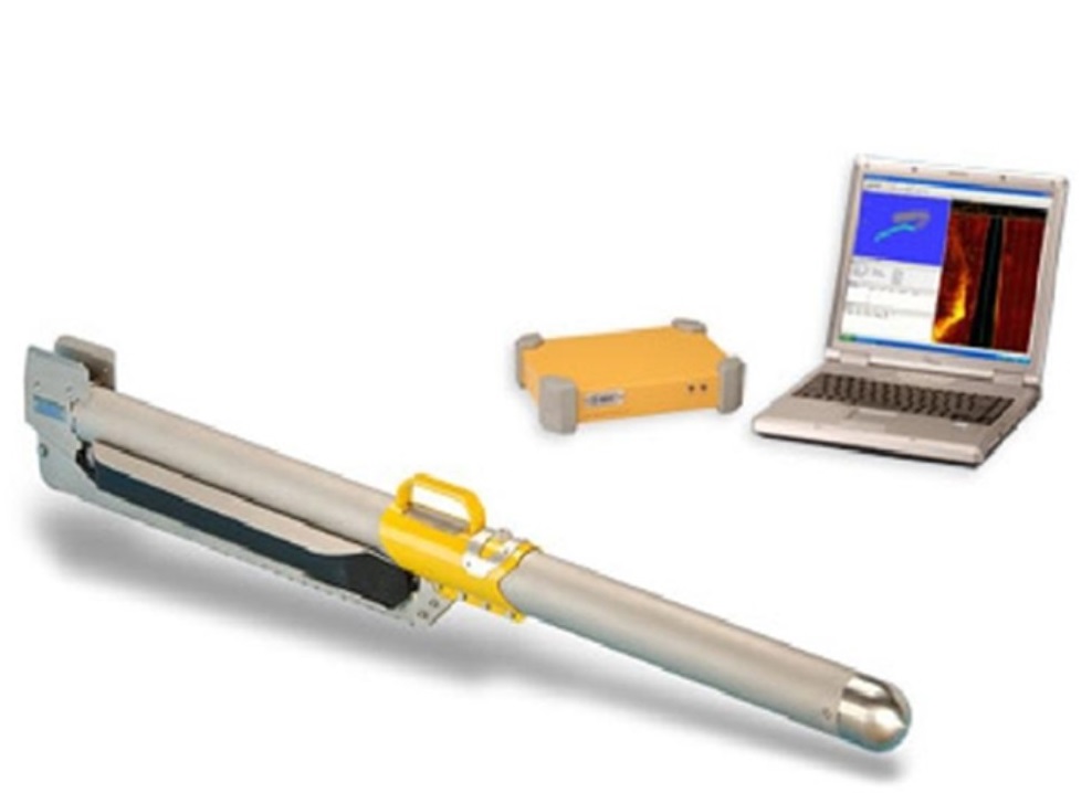
MAX CM2 specifications
| Speakers frequency | 100 kHz (LF); 325 kHz (HF); |
| Width of the coating (the left and right sides of the towed device) | 25 m, 50 m,75 m,100 m,150 m (HF); |
| 100 m,200 m,300 m,400 m,500 m (LF). | |
| Power and pulse duration | 217дБ in 1 mkPa on 1 m; duration depends on the distance, for example,, 50 m –53 mk/sec. |
| Depth resolution | 78mm on 325kHz (not with a width of coverage 25m), 156mm при100kHz |
| Angular deviation of the rays (from the axis of maximum sensitivity) | 10º or 20º, rebuilt without tools. |
| Maximum depth of the dive | 2000 m |
| Maximum working speed | 6 knots or 3 m / sec. |
| Maximum towing speed | 12 knots or 6 m / sec. |
Magnetometer Sea spy Marine Magnetics
| |  | The sensitivity of 0.01 nT Accuracy: 0.2 nT The range of sampling: 4 [Hz] - 0.1 [Hz] Power consumption: 1W Standby 3W maximum Stability of time base: 1 ppm 45ºC to +60 ºC Range: 18.000 - 120.000 nT Gradient tolerance: over 10.000 nT / m Data transfer rate: RS-232, 9600bps Power supply: 15VDC-35VDC or 100-240VAC
|
Global Navigation Satellite Systems (GNSS)
Acoustic and Seismoacoustic Profile Recorders
Feedback works on website. Here you can ask the question and get a full and complete reply to your E-mail

Partnership